Carbon Glacier
June 18, 2005 - Me and Michael
7 Miles rt - 1,400 ft elevation gain - maximum elevation 3,600 ft
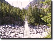
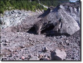
Many a North westerner got his or her first close rub with a glacier here, on a trail that can be an easy day hike to the Carbon Glacier or an overnight trip/exhausting day hike to Mystic Lake. The Carbon Glacier Trail, actually part of Rainiers Wonderland Trail, leads gradually upward two miles from Ipsut Creek Campground to a junction with the Northern Loop Trail and then turns upward along the Carbon River to a junction with the Spray Park/Seattle Park Trail at about three miles. Just beyond here you come to a rather lanky suspension bridge over the river. The bridge is not for the faint-hearted, who can bypass it by backtracking, hiking east OJ mile on the Northern Loop Trail, then turning right and proceeding up the other side of the river on the Mystic Lake Trail. Once safely across, turn right and follow the moraine steeply upward to an excellent viewpoint of the glacier, the lowest-elevation glacier in the Lower 48 states and one of the more melt-resistant ice fingers on Rainier. Most people stop here at about 3.5 miles; the trail beyond shows why, as it gets steep, rocky, and downright ornery for approximately the next mile up to Dick Creek Camp.
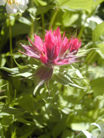
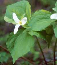
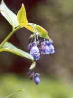
Beyond, you enter the delightful Moraine Park area, where wildflowers and views collide to leave you spellbound. Continue onward and upward on the Wonderland Trail toward Curtis Ridge and you find yourself at Mystic Lake, so named because early explorers noticed an unexplained whirlpool in the water. Look for it yourself by plunging your head into the icy water, removing it, then screaming quite loudly. Shake your head and close your eyes. See the spinning water? We thought you would. When you recover, gaze south at to-die-for views of Rainiers extremely handsome north face, marked by the unmistakable, 3,500-foot rock face known as the Willis Wall. You also find a summer ranger camp here and, rest assured, the ranger will remind you to camp in designated sites one-half mile farther down the trail, not at the lake. Heed the advice.
Directions: From Puyallup drive 13 miles east on Highway 410 to Buckley. Turn right (south) onto Highway 165. Proceed to the bridge over the Carbon River Gorge and then bear left to Mount Rainier National Parks Carbon River entrance. Proceed five miles to the trailhead at the roads end at Ipsut Creek Campground.